File:Woodfield Area Maps.jpg
From Flexible Survival

Size of this preview: 562 × 600 pixels. Other resolutions: 225 × 240 pixels | 1,917 × 2,046 pixels.
Original file (1,917 × 2,046 pixels, file size: 153 KB, MIME type: image/jpeg)
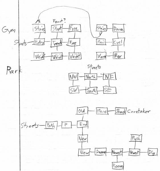
A hand-drawn map of the three existing dungeons in Woodfield City.
File history
Click on a date/time to view the file as it appeared at that time.
| Date/Time | Thumbnail | Dimensions | User | Comment | |
|---|---|---|---|---|---|
| current | 23:00, 23 May 2011 | | 1,917 × 2,046 (153 KB) | DeMatt (talk | contribs) | A hand-drawn map of the three existing dungeons in Woodfield City. |
- You cannot overwrite this file.
File usage
There are no pages that link to this file.