File:Fairhaven Map.png
From Flexible Survival

Size of this preview: 558 × 599 pixels. Other resolutions: 223 × 240 pixels | 1,200 × 1,289 pixels.
Original file (1,200 × 1,289 pixels, file size: 367 KB, MIME type: image/png)
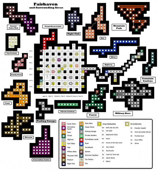
This map was previously made by someone else, Kalos I think. I've trimmed out a bunch of the whitespace and removed the Corn Maze and instance maps, so that the wiki doesn't choke on how big it is.
File history
Click on a date/time to view the file as it appeared at that time.
| Date/Time | Thumbnail | Dimensions | User | Comment | |
|---|---|---|---|---|---|
| current | 21:36, 12 October 2011 | | 1,200 × 1,289 (367 KB) | Atrius (talk | contribs) | Added Mountain Path, Somnium Gardens, and the Red Court. Split Forest and Military Base. |
| 00:23, 30 September 2011 |  | 1,200 × 1,292 (347 KB) | Atrius (talk | contribs) | Slight corrections. Location of Scrublands moved left. | |
| 04:43, 20 September 2011 | 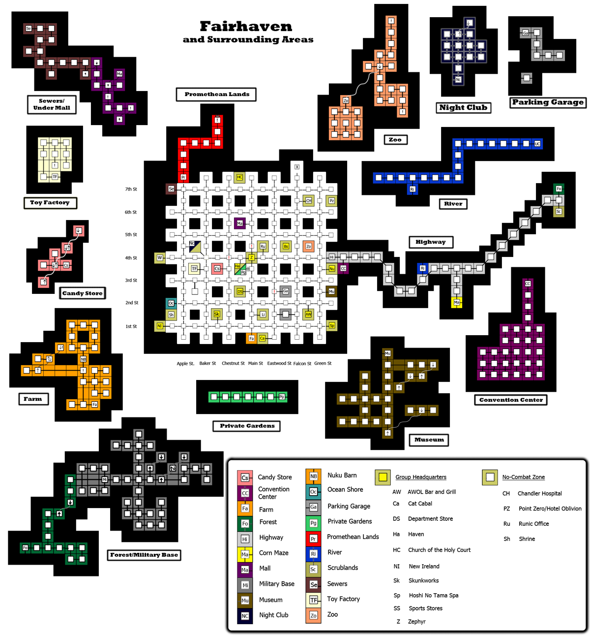 | 1,200 × 1,292 (347 KB) | Atrius (talk | contribs) | Font Larger in Legend. Corrected Zephyr's type to Group headquarters, rather than no-combat zone. Elimination of unneccessary data appendage to file. | |
| 05:03, 14 July 2011 | 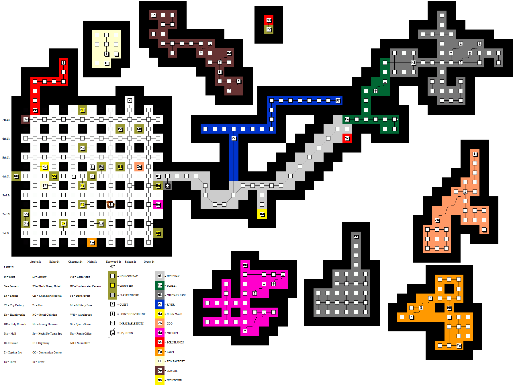 | 1,790 × 1,350 (147 KB) | DeMatt (talk | contribs) | This map was previously made by someone else, Kalos I think. I've trimmed out a bunch of the whitespace and removed the Corn Maze and instance maps, so that the wiki doesn't choke on how big it is. |
- You cannot overwrite this file.
File usage
The following 6 pages link to this file: